
Passage to Easter Island (cont.)
Wednesday April 1, 2009
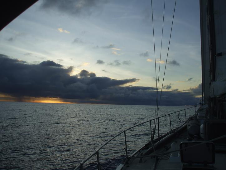
Day 14. After quite a boisterous 16knot SE wind with the occasional squall passing by, the wind died down to a very sedate 6 to 8 knots all day and the seas with it. We made our way gently along at 5.5 knots and occasionally slumped as low as 4.0 knots, the lowest we´ve seen for a week now, and all seemed right with the world. The water is cobalt blue, the occasional white cap highlighting just how clear it is. One gets the feeling you should almost be able to see a sandy bottom any minute.
Since it was so calm today, comparatively speaking, Michelle did some guitar practice and Robin read a book. And one could almost walk around the boat without fear of being catapulted against a wall at any given second.
Not a single piece of wildlife other than a one inch long flying fish found in the cockpit. We were wondering if it accomplished the amazing feet of jumping 5 feet over the freeboard and into the cockpit or was tossed onboard by an errant wave. Talking of errant waves we had 2 enormous waves break into the back cockpit last night dumping a few gallons of water each time. Fortunately we were downstairs and just stood gaping open-mouthed at the whirlpool draining out through the scuppers.
We gave ourselves a wee fright last night trying to work out why the GPS seemed to be in error and was taking us east of our waypoint at Easter Island. We had done the adjustment for that latitude being 12 degrees difference. Nothing seemed to be computing. Of course we had forgotten that between 10 degrees south and 25 degrees south we traverse through various magnetic corrections and at last night´s latitude the correction was only 9 degrees. DOH! Fortunately the GPS has known this all along and has been quietly adjusting things as we go along.
Okies enough blather... position 23.27S 106.05W COG 207 degrees. SOG 5knots DTD289nm.
Thursday April 2, 2009
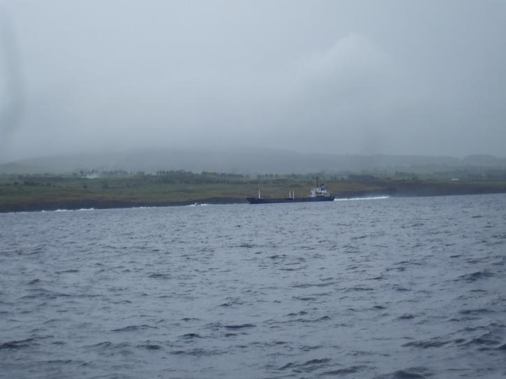
Well yesterday was literally the calm before the storm. Instead of playing guitars and reading books we should have been sleeping to build up some reserves! It has been a tiring 24 hours. We had rain squalls start at 6pm (24:00 UTC) last night and they continued on through to the end of Michelle´s watch at 3am in the morning. Some of the winds hit 30knots, the seas churned up and rough. There wasn´t much rest. This morning around 7am we had a surprise encounter with Geo Searcher 6, a research vessel conducting seismic readings. He was towing a 5 mile long cable behind the boat which made getting round him exceedingly difficult and in the end we had to cross his bow, a manoeuver we never want to have to repeat. The captain of the vessel congratulated us on a job well done then on comes an aussie accent. There was a guy from Australia on the research vessel and he wanted to chat. Isn´t it amazing where you find us Aussies.
Position at 22:00 zulu 25.30N 108.00W. COG 107 degrees. SOG 8 knots. DTD 124nm. We should make landfall tomorrow. Yes we are getting excited but also a little trepid as we really do not know what to expect regarding anchorages and if the weather will allow us to stay. All will be revealed soon.
Easter Island
Friday April 3, 2009
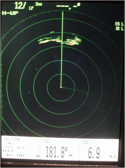
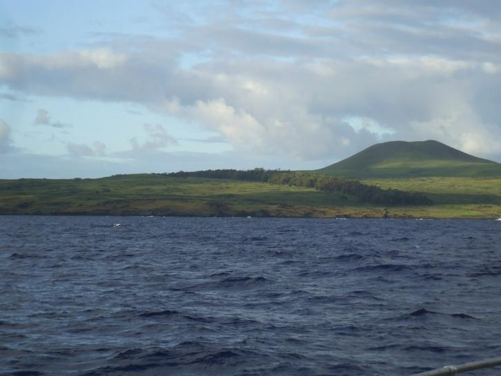
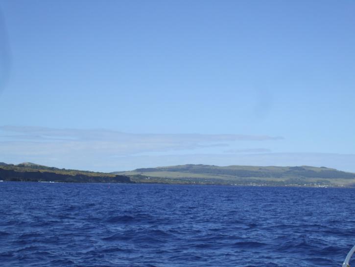
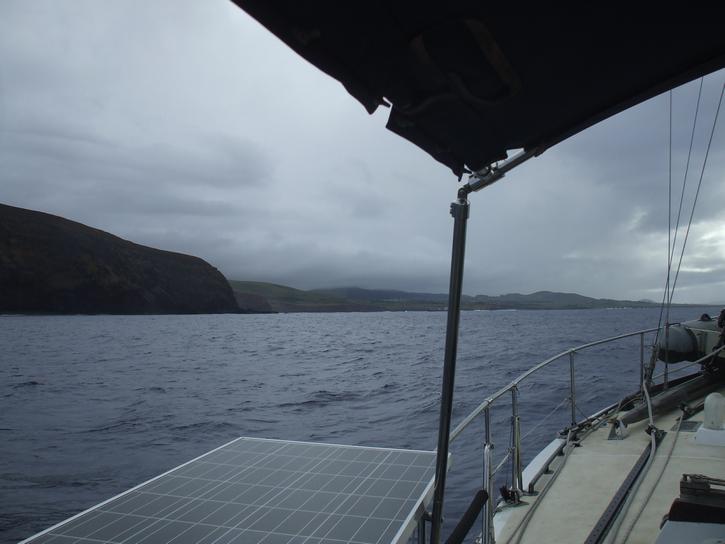
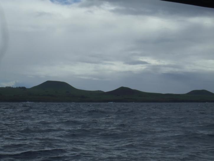
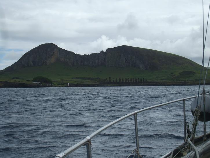
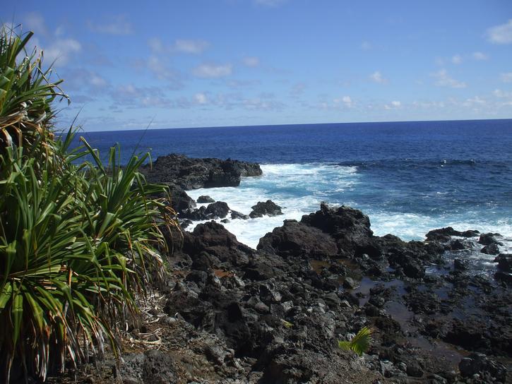
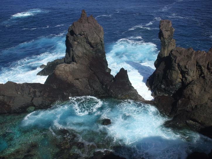
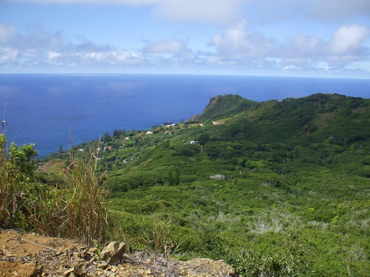
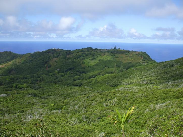
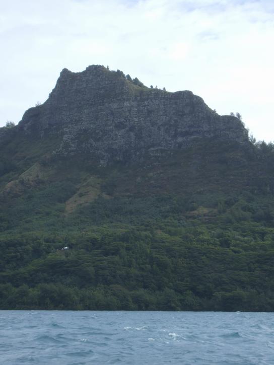
We were pretty excited during last night´s watch, waiting with baited breath for Easter Island to appear on the radar. We have a range of 24 miles and right at the end of Michelle´s shift, just as Robin was taking over she says, there´s a rain squall just on the edge of the radar. Then she goes to bed. An hour later Robin realized he was looking at Easter Island! By the time Michelle woke up, the island was clearly portrayed on the Radar and as soon as it was light Michelle was outside squealing with glee. The two mountains Maunga Terevaka (507 meters) and Maunga Pukatikei (400 meters) made for a dramatic skyline in the dawn twilight.
 |
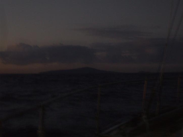 |
| Easter Island on the radar and our first glimpse of the island in the dawn twilight. | |
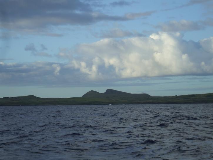
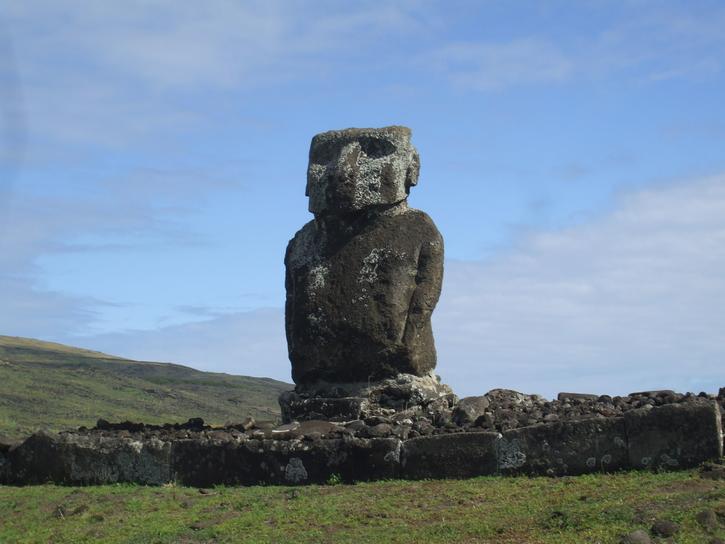
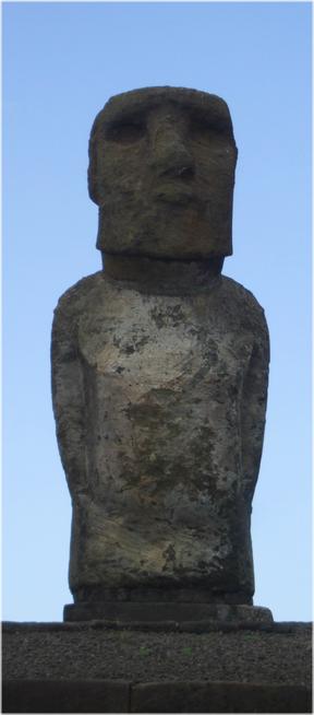
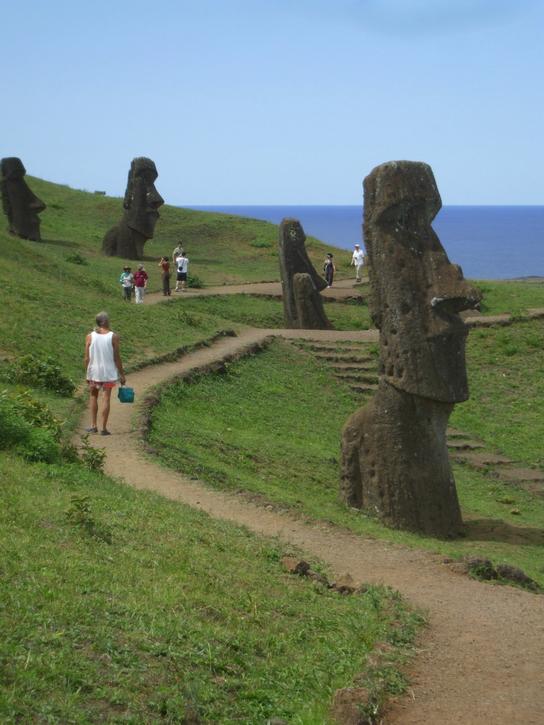
We decided to head up into the wind and head directly for the middle of the northern shore then tack along this coast to check out the bay of Anakena in case we have to anchor there. It looked absolutely gorgeous with its white sand beach. Then we caught our first sighting of the famous moai, both of us fighting over the binoculars to get a better look. Afterwards Robin declared ok we can leave now we´ve seen the statues!
 |
 |
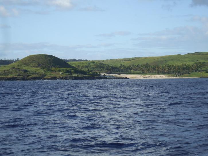 |
| The Northern end of the island - the 3rd photo has the moai | ||
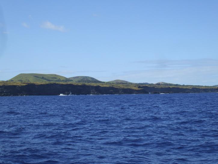
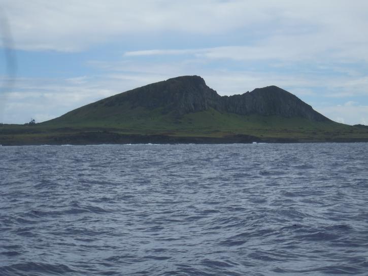
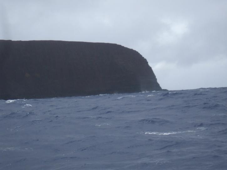
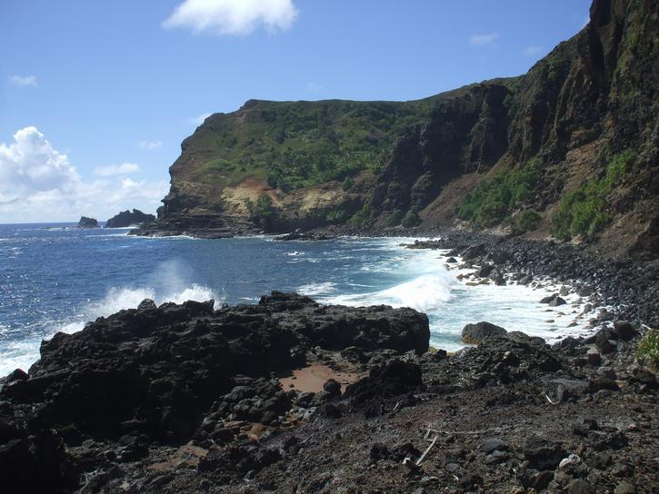
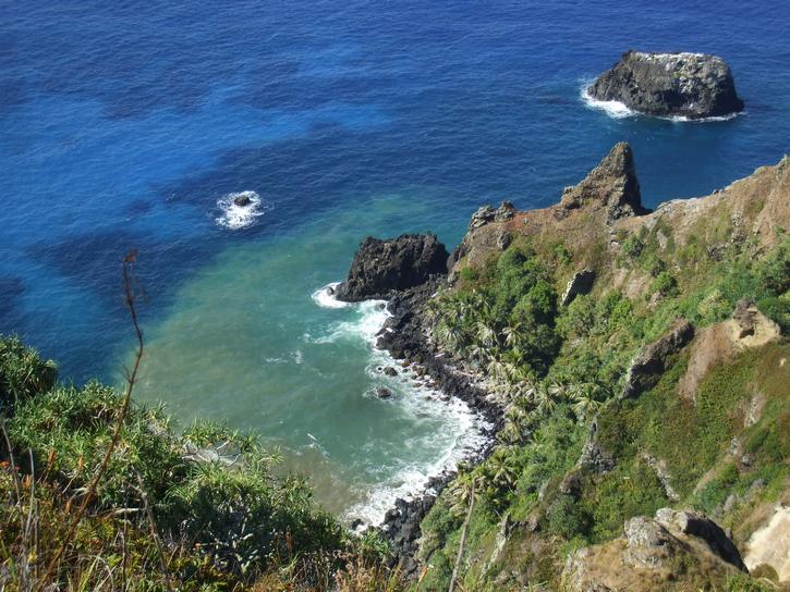
We made our way slowly around the north-eastern end of the island, greedily drinking in the sight of land after 16 days at sea. We were so excited to get checked in and get ashore. We had the anchor down at 11:30am, called the Armada and dangit, they wouldn´t be out to clear us in until 3:00pm this afternoon. You mean we have to wait THAT LONG BEFORE WE CAN GO ASHORE... ARGH! Such a tantalizing tease!
 |
 |
 |
| West side of the island and approaching the township of Hanga Roa | ||
While we were straightening up the boat for the official visit, we found a few repairs that needed doing. The webbing on the very top slide of the mainsail (which holds the sail to the mast) had worn through and we also wore through a reef line. So we began work on those repairs while we tried not to count the minutes. The official welcoming committee finally arrived at 3:30pm and 7 guys clambered onboard, 3 with something to do, the others to just take a look at how the other half live. But they were all a ton of fun and the process went smoothly. Then the sniffer dog did his thing and declared us healthy and we were finally off ashore.
The dinghy ride ashore is quite something. There are breaking waves to the right complete with about 50 people on surfboards waiting for that perfect wave; there are breaking waves to the left around a rocky islet and reef; what remains is this narrow channel where for some reason the waves don´t really break (well when the waves are less than 2.5 meters as they were today) and you line yourself up and head on in as fast as you can. At first you can´t even glimpse the tiny caleta which shelters a dozen pangas all tied bow to the rock wall and stern tied to a rope which stretches across the entire caleta. Neat way of keeping the pangas from dashing themselves to death in the constant surge. Anyway we finally worked out a spot to leave the dinghy without it killing itself on the sharp rock wall and went to explore the lay of the land. First thing that greeted us was Ahu Tautira with two moai. Of course we forgot the camera! On the way into shore we had stopped to chat quickly with one of the two other yachts anchored here, Nine of Cups with David and Marcie onboard, and they had mentioned hiring a car to see the island, so this was the first order of business. We knew we´d probably only have one good day and we wanted to see it all. So car organized for tomorrow, we scouted out the supermarket which was surprisingly empty of most goods, then we hit a couple of other small stores and finally headed for a B E E R and some dinner. We had been warned in the Lonely Planet guide that the food on Easter Island was nothing worth mentioning but we found dinner good tucker mate! Maybe we have been eating ship´s stores too long.
Saturday April 4, 2009
Armed with sandwiches, water bottle, guidebooks, camera, sunglasses, and lip UV protection we left the boat determined to see every inch of Easter Island. We know we will probably only get this day ashore as inclement weather is about to bear down upon us and we will need to shift the boat.
We arrived at the car rental place and the owner appeared and gave us a 20 minute lecture on what to do and not to do with the car. He was most concerned about speeding and wild horses. These wild horses reportedly rampaged, kicked at cars, ran out in front to try and commit hari kari etc etc. We tried to reassure him that we live on a boat that averages 5 knots and anything over walking pace these days is truly frightening. We finally managed to extricate ourselves from his protestations and got underway. Guess we look like a very irresponsible pair!
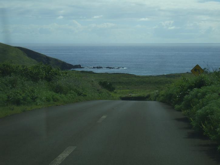
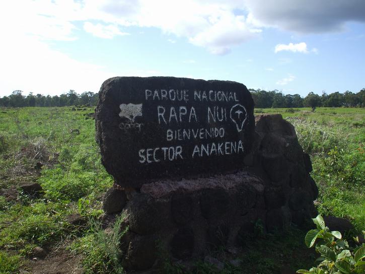
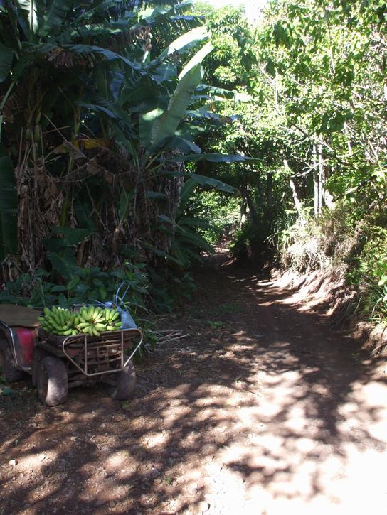
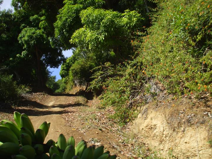
We had studied all the information our fingers could find and decided to tackle the northernmost end of the island first while the good weather held and where we would be furthermost away from the boat. So first stop Anakena Cove which we saw from the boat the other day. Everything is so green and lush looking and around every other bend you have a stunning vista of greenery with an ocean backdrop. We found the wild horses, and seriously had to laugh. They were all branded, all the males were gelded, and were not in the slightest interested in us. We guess wild meant allowed to roam wherever they want for food, not wild in the sense that no man goes near them!
 |
 |
 |
| The beautiful lush countryside of Easter Island | ||
A note before we start. AHU are village burial sites and ceremonial centers thought to have their origins in French Polynesian altars. MOAI are the massive carved figures usually found on or around AHU. The topknots or PUKAO are believed to represent a hairstyle once popular on the island. MOTI are offlying islands or rocks. So armed with these archiological names we were prepared.
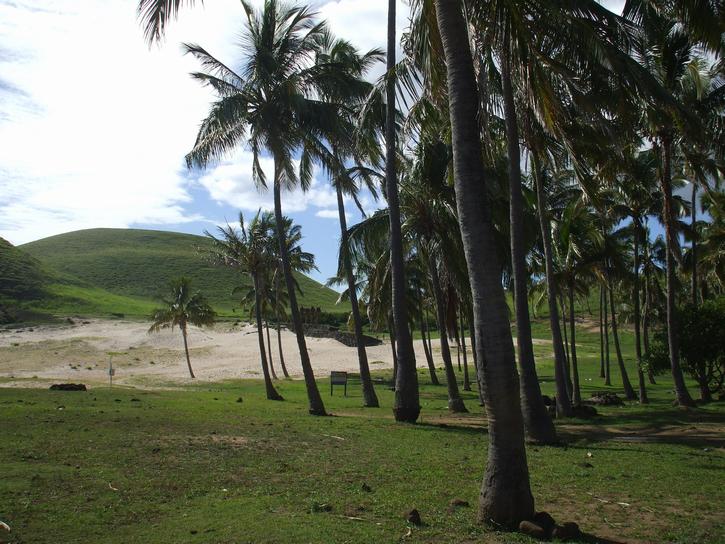
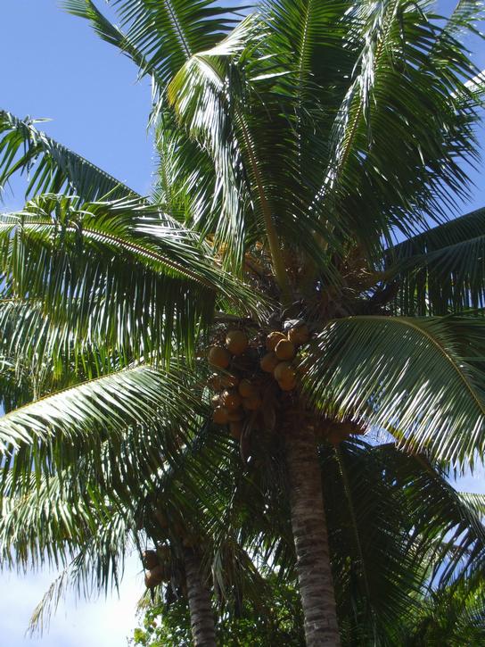
Anakena was as gorgeous as it appeared from the boat, lined with numerous coconut trees and probably the closest we have come so far to imagining ourselves in the South Pacific. This is the "main kick back and wallow in the sun" beach of Easter Island.
 |
 |
 |
| Anakena | ||
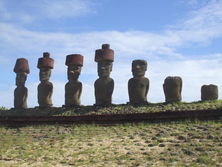
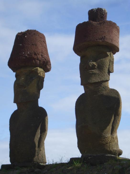
We made our way over to Ahu Nau Nau which supports seven moai some with topknots. Since these were the first moai of the day we stood mesmerized, pinching ourselves to check that we were really here seeing these massive statues. The bay housed another Ahu on a rise on the south side, Ahu Ature Huki with its loan moai. Apparently it took Heyerdahl (of Kon-tiki Expedition 1947 fame) and a dozen islanders more than 20 days to lever this statue back into place using wooden poles and ropes. Almost all moai on the island have their backs to the sea and were situated overlooking their village.
 |
 |
| Ahu Nau Nau and its seven moai | |
 |
|
| Front and Back view | |
 |
| Ahu Ature Huki and its massive moai |
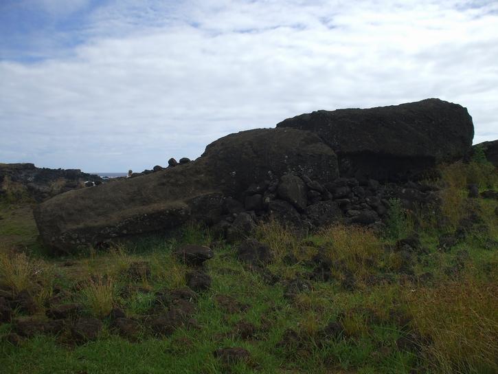
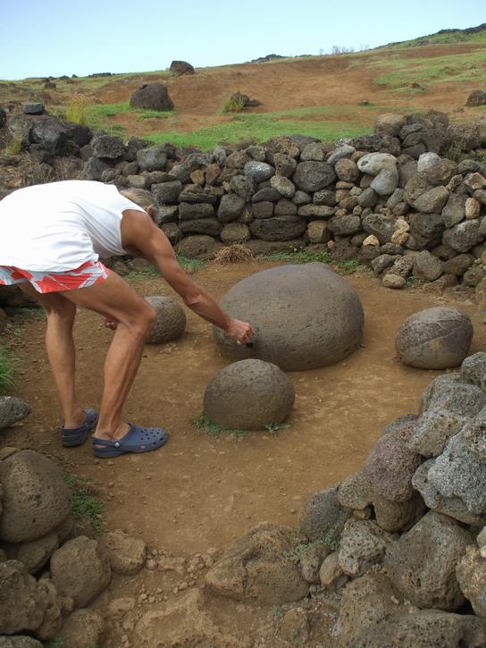
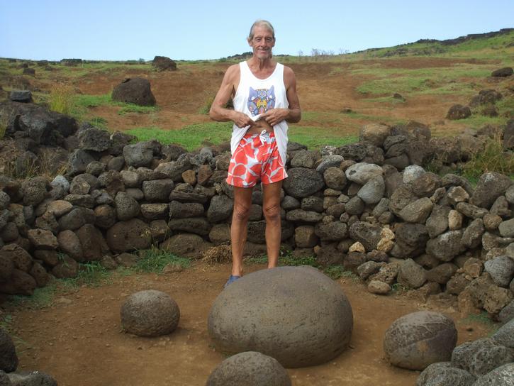
Next stop was Ahu Te Pito Kura with its enormous broken statue doing a face plant in the dirt, its neck broken. This guy was over 10m long. Can you imagine what it took to move him from the carving site to here? Because of its resemblance to the unfinished carvings at Rano Raruku experts believe this was a fairly modern moai. This Ahu´s name comes from a round stone which is found about a stone´s throw away from the fallen moai and is believed to symbolize the navel of the world. Robin did the magnetic test with the car keys but couldn´t get a reaction. Keys these days!
 |
 |
 |
| Ahu Te Pito Kura - Navel of the Universe | ||
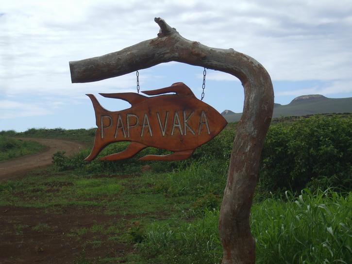
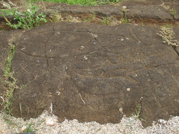
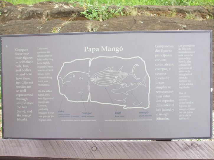
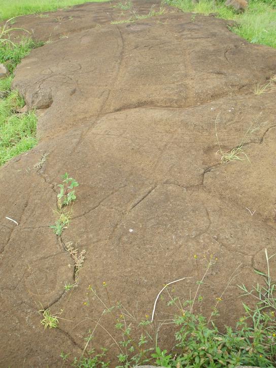
A few meters further along the northern coast we stopped to take a peak at some petroglyphs at Papa Vaka. An information board informed us that this was a ceremonial site where they carved these petroglyphs which showed the ancient concern about the sea and the control of its resources. There are a number of symbolic figures closely associated with the sea such as fishhooks, canoes and various marine creatures. Robin, the ever ready quip artist, offered the alternative perspective that it was probably a site where kids were sent to entertain themselves by carving pictures in the molten rocks. Whatever the case, some of the petroglyphs were fairly elaborate affairs, others you could barely make out, they were so eroded and if it weren´t for the information panels portraying what it was supposed to be you would have been hard pressed to make anything of it at all.
 |
 |
 |
| Petroglyphs and information panels | ||
 |
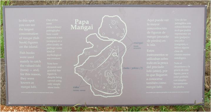 |
| The largest and most famous petroglyph of the island - Papa Mangai | |
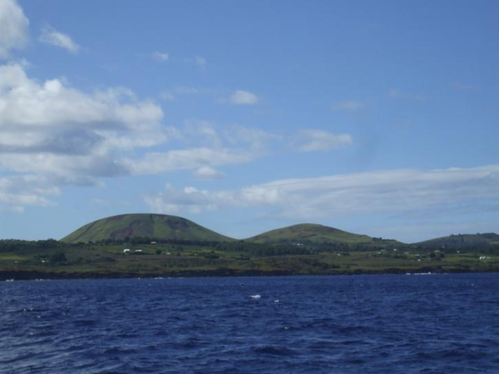
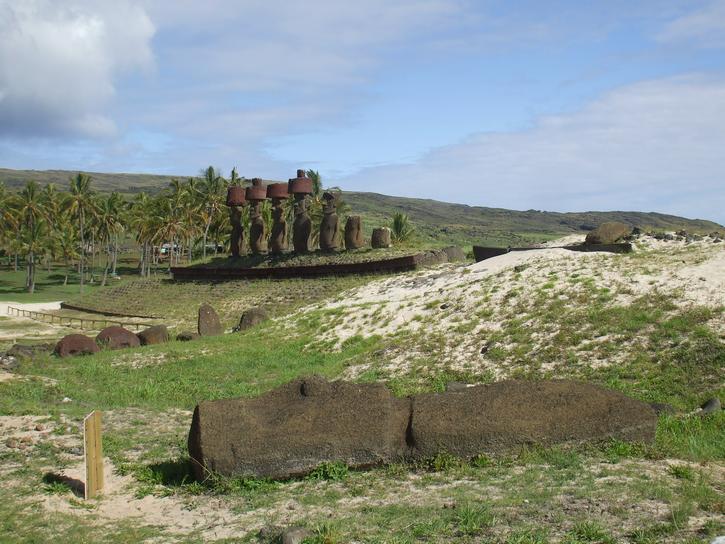
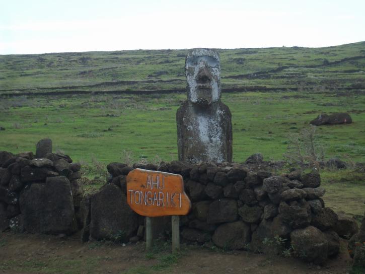
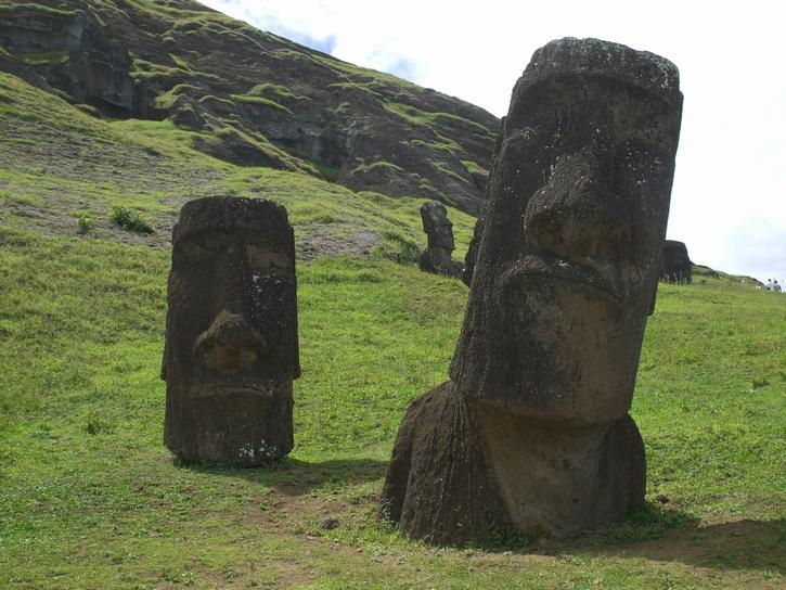
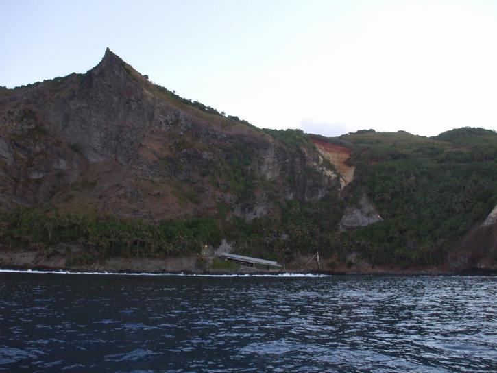
Having done with the northern end of the island, we skirted around to the eastern side. We had to give Penisula Poike a miss as vehicles are prohibited and we didn´t have time to hike in and explore it. Nevertheless the view was stunning as we wended our way towards what is probably the most photographed statues on the island, Ahu Tongariki. Ahu Tongariki overlooks Hutuiti Cove where we as it turns out we would bring Warrior tomorrow to shelter from the incoming weather.
 |
 |
| Hutuiti Cove | |
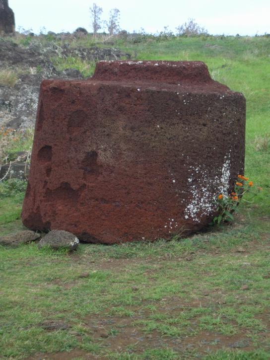
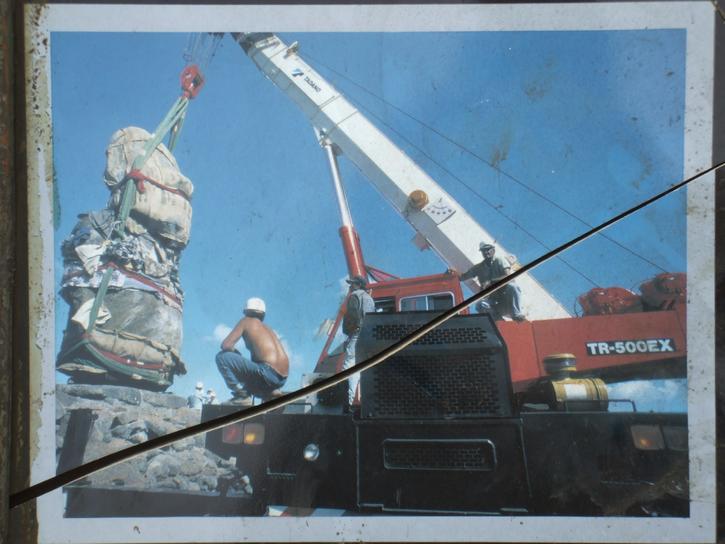
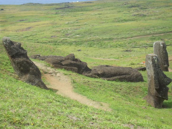
The massive figures of Ahu Tongariki have had a few upheavals in their time. Apparently they were first toppled in the 17th century on account of tribal warfare. Then a 1965 tsunami had ripped the statues from the Ahu, scattering pukao before them. 15 of them were raised by the Japanese between 1992 and 1995. Only one topknot was returned to its owner but some of the others are lined up over to the side. These are the statues we of course know well in Australia because of the resemblance one of them had to one of our former Prime Ministers, Malcom Fraser. Much fun was made of him by cartoonists. The statues here gaze over a large level village site and you can just get an idea from the remnants lying about. There was also a large petroglyph here of a turtle.
 |
 |
 |
| Which one was Malcolm Fraser Robin - This one! Are you sure? | ||
 |
 |
 |
| No wooden poles and ropes for the Japanese | ||
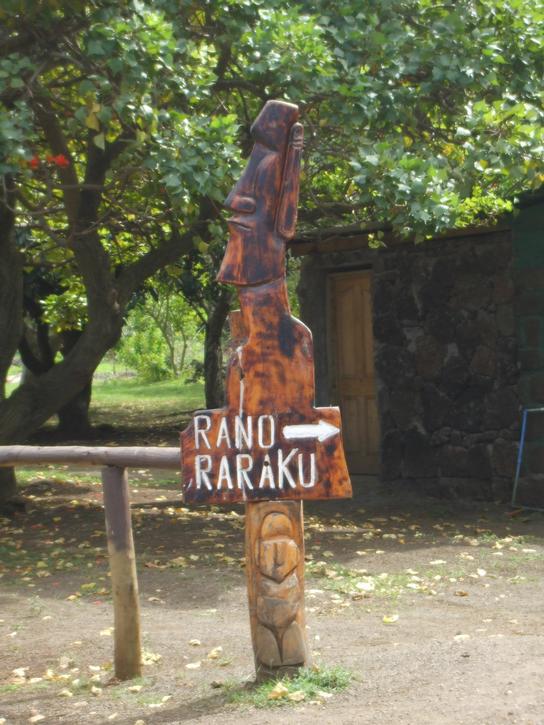
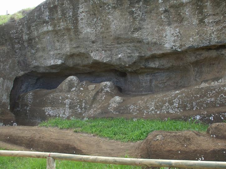
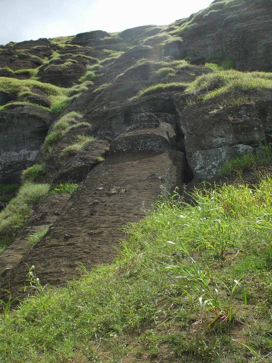
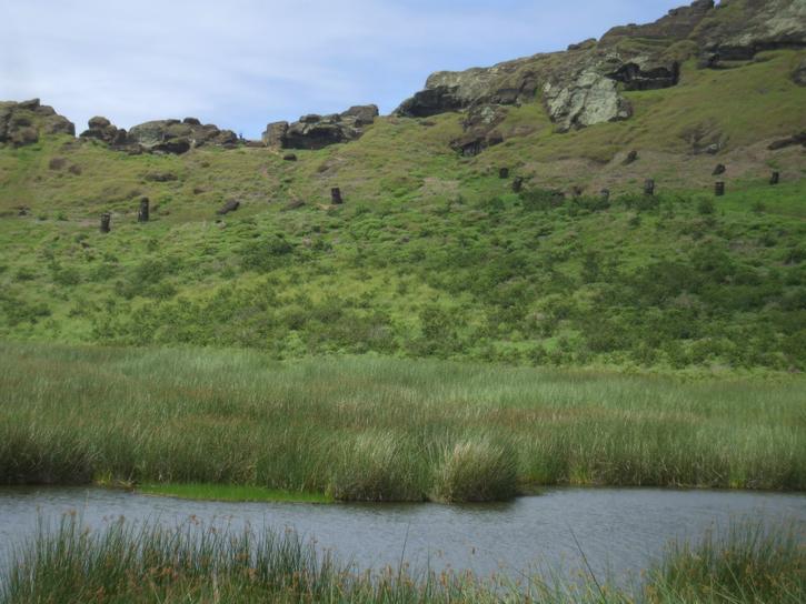
Next stop was Volcano Rano Raraku which was totally captivating. This was the quarry from which most of the island´s moai were carved and here you can find, dotted across the southern slope of the volacano, moai in all stages of progress. There are dozens of sizes and styles; they are found in various poses, some partly buried with just their heads poking out, others still not quite detached from the tuff of which they are carved. The largest was 21m. The smallest around 2.5m. According to our trusty guidebook, this was the workshop and distribution center and all the moai were transported from here once finished. The trail around the site was 1500 meters long and we could have spent all afternoon just at this site.
 |
 |
 |
 |
 |
 |
 |
 |
Once we were done checking out the megaliths we wandered up the trail to the rim of the crater and were surprised to find a lake and more moai dotting the inside slopes. It would have been the perfect spot to curl up with a good book and while away the afternoon but alas the weather was deteriorating and we needed to keep moving.
 |
 |
| View inside and outside of the crater | |
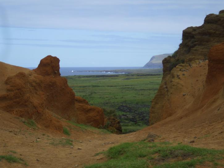
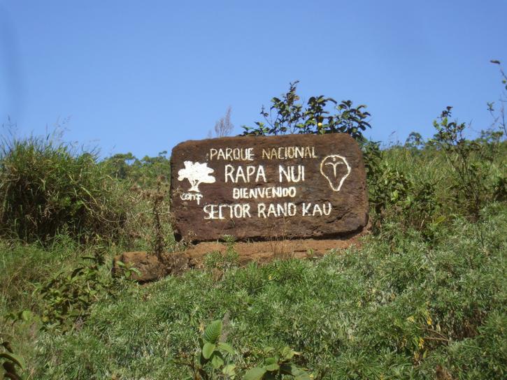
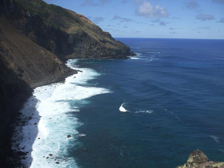
We headed back along the coast road towards the south end of the island knowing we had to make tracks now. The VHF radio had been blessedly silent so we knew all was well with the boat but we could see heavy cumulus approaching from the west and figured our hours were numbered. We made a few stops along the way, checking out more toppled moai, a few Ahus, the rugged coastline and a pretty neat cross. We took a short cut via a dirt track around the back of the airport and connected with the road that would lead us up to the top of Rano Kau, the last area we would be exploring today.
 |
 |
 |
| Views along the coast | ||
 |
| View from the top looking back over the anchorage of Hanga Roa Note the approaching weather |
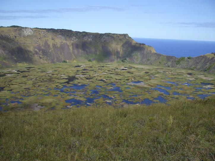
Rano Kau is a volcanic crater and it took our breath away as we approached it. We stood gaping with mouths open at the sight laid out before us. It was semi covered in floating totora reeds and it looked all the world like an evil witch´s cauldron.
 |
 |
| The crater of Rano Kau | |
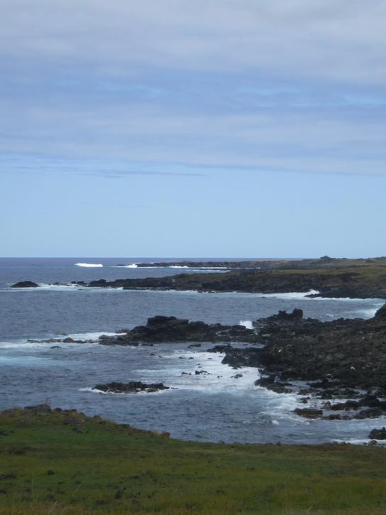
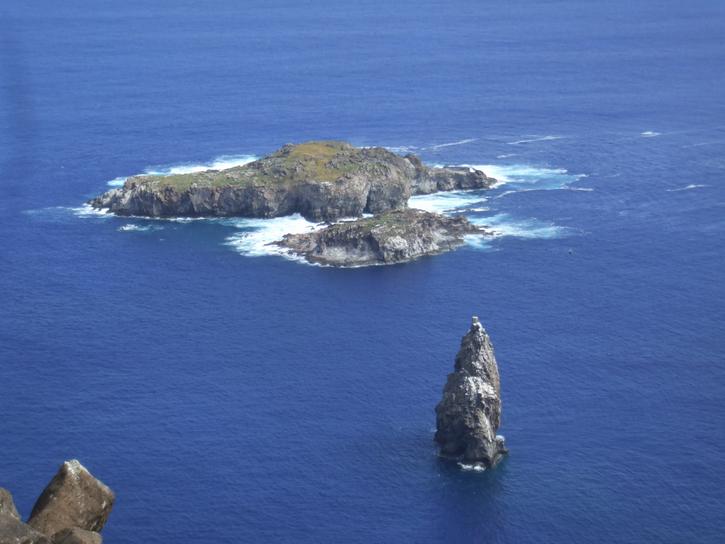
Leaving the rim of the crater we wandered around a trail to a lookout point out over the motis or islets just off the south shore. Breathtaking view.
 |
 |
| Offshore motis seen from Rano Kau | |
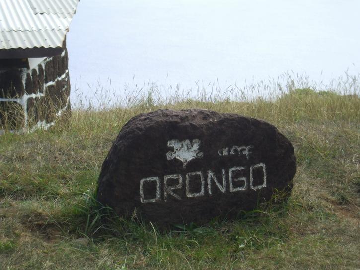
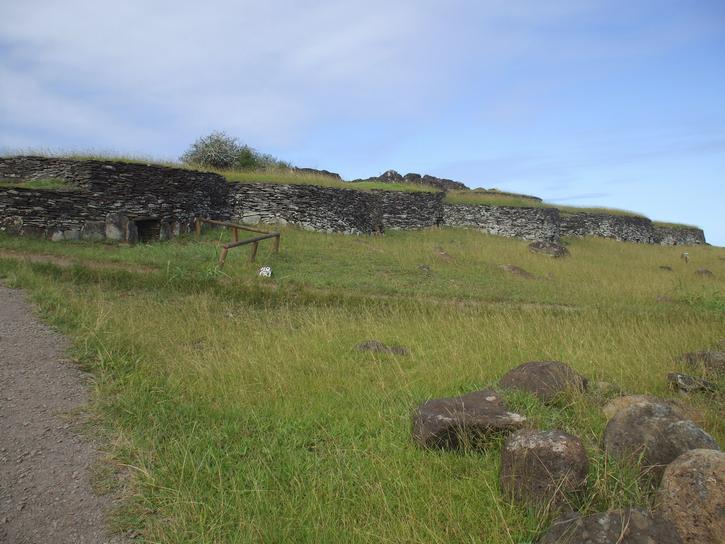
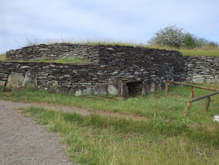
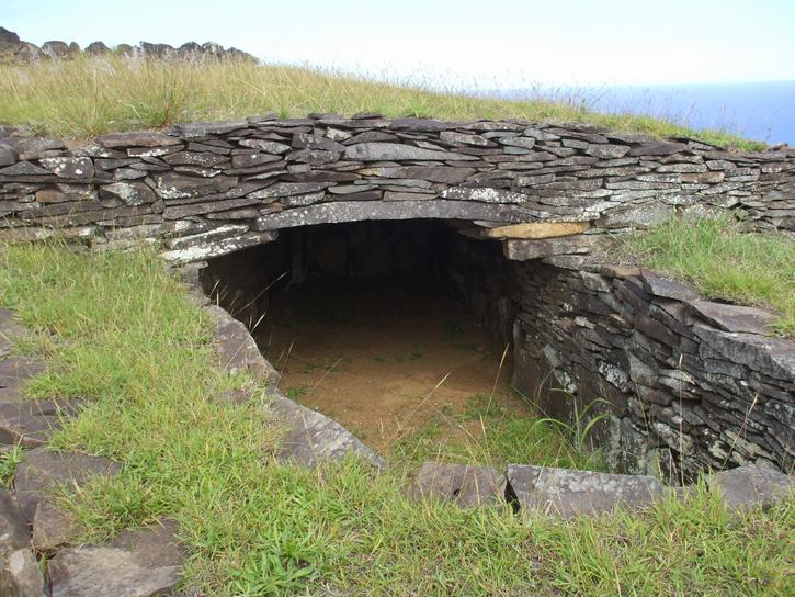
400 meters above the crater, perched on the southern edge with a vertical drop plunging vertiginously to the ocean, was the Orongo Ceremonial Village. This village was comprised of 54 houses, and is dated at around the XVI century. The information boards at the site stated that by the 18th and 19th century, the island society was leaving megalithism, the moai we had been looking at all day, and had replaced it with the cult of the Makemake god, the religion itself drawn from spring celebration, fertility and migratory sea-birds. Birdman petroglyphs are visible on a cluster of boulders. The houses themselves were constructed of small stone slabs, layed horizontally on top of each other, with an earth-covered arched roof of similar slabs. This made them appear partly subterranean. We are not certain weather the doorways really were as small as they appeared or weather the houses have been silted in. The flagstones were quarried from the rock found at the top of the crater.
 |
 |
 |
 |
| Orongo Village | |||
At this point we had to give up. We missed out on the museum (always Robin´s favorite) and the special moai not far from there which has had his eyes restored. We stopped quickly to buy a few supplies, fill up a jerry can with diesel, Robin dropped Michelle off at the dinghy dock where she bailed water out of the dinghy for 20 minutes while he returned the car. The weather was truly beginning to fall apart and we were happy to be getting back to the boat where we could monitor things. That concluded our day on Easter Island. There was more to see, we missed the entire western shoreline and Penisula Poike, both of which are better covered by hiking in. We could easily spend a week on Easter Island leisurely exploring the wonders that are here.
Sunday April 5, 2009
The stormy conditions of last night stayed with us and this morning we woke at the crack of dawn to find that the wind and waves had come around to the west. This meant one thing. It was time to relocate as this anchorage would soon become lethal. Even Geo Searcher 6, who had arrived sometime yesterday, moved not long after we did.
 |
| Exactly what you don´t want to see when you wake up to worsening weather You ass facing onto a lee shore! |
Of course it wasn´t so rough that we were going to miss out on cruising the south part of the island so we bashed our way down the couple of miles to the bottom of the island then took a left and had a breathtaking, less than 250 meters up close and personal, sail off the pinnacle rock of Motu Iti. To the left of us was the backside of Rana Kau crater lagoon complete with landside. We were wondering how long before the lagoon lake busts out.
|
 |
 |
| Views from the south end of the island | ||
Sailing past Vinapu we definitely decided the better anchorage would be Hutuiti Cove and thus we kept going retracing the coastline that we´d driven down yesterday. We pulled into the cove and the first thing we notice is the 15 moai all now mooning us! We found a good patch of sand and dropped anchor. If the wind does what it´s forecast to do then we should be well sheltered here for the next 3 days or so.
 |
 |
 |
| Rounding southeast corner past Vinapu with visiting oil tanker | ||
 |
 |
 |
| Views from the east side of the island | ||
This afternoon we finally finished resewing the webbing on the mainsail and replaced the broken reef line. So we are good to go again.
Wednesday April 8, 2009
The last three days have been interesting. Well in the hunker-down-try-and-lay-low kind of sense. We had a strong northerly blow through and the wind culminated in 35 knots today. We are sheltered from the big swell from the north associated with the northerly but the south westerly swell is reaching us although it´s fairly gentle. We are safely anchored with over 300 feet of chain out and we made all new rope snubbers so Warrior is riding well. There was no way we could have gotten ashore here without getting completely drenched and probably getting tossed in the process. Geo Searcher 6 came to join us for a day while they went threw a crew change. They had tried to ride out the storm down at Vinapu where the oil tanker was but it was horribly rough. The other two boats who were with us in Hanga Roa are also here in Hutuiti, Nine of Cups with David and Marcie and La Rabas, a French couple, Felix and Magali. Of course what else do you do when the wind is howling and you take your life into your own hands just getting into your dinghy? You have dinner and drinks on each others boats and swap numerous stories about sailing etc. This we have been doing the last three days and we have really enjoyed getting to know these people and listening to their adventures. David and Marcie did the Magellan strait. After listening to their tales are not tempted!
 |
 |
 |
| The sun came out, the wind blew and Geo Searcher 6 | ||
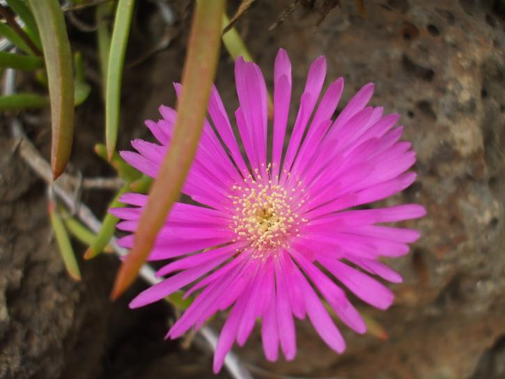
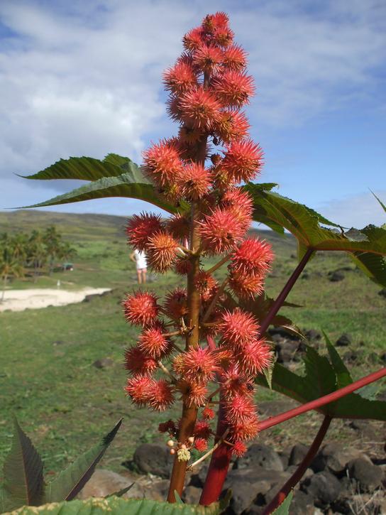
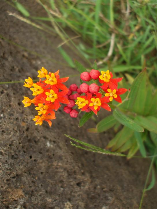
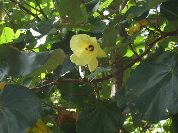
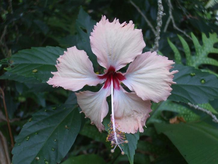
We will leave you with some snapshots of wildflowers and flora we came across while ashore.
 |
 |
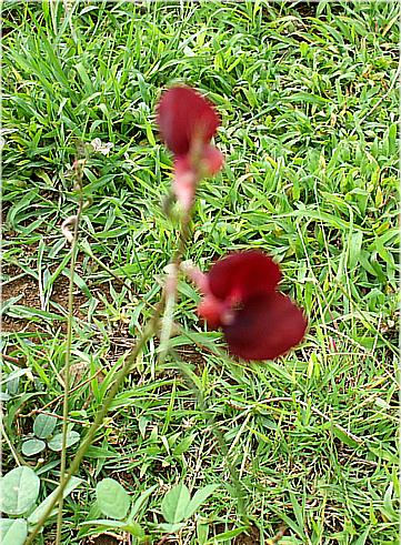 |
 |
| The odd wildflower Michelle came across | |||
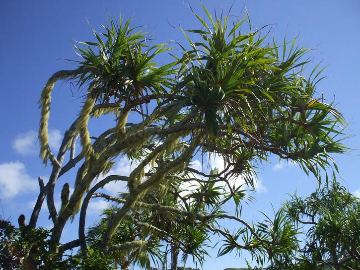
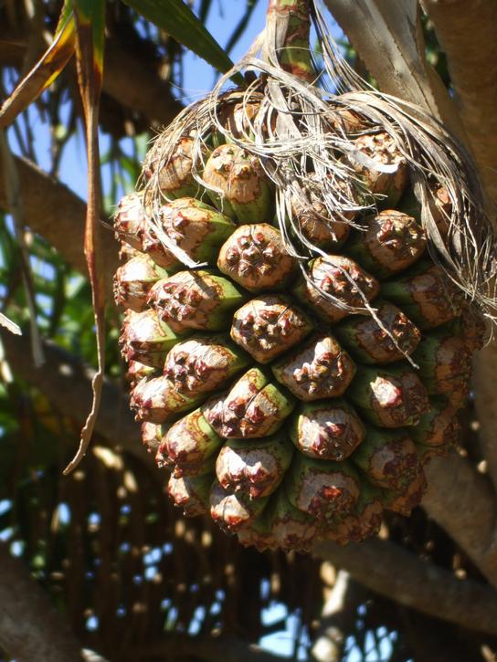
 |
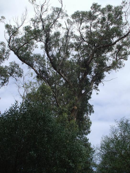 |
 |
| Robin insisted on photographing a gum tree! | ||
Pitcairn Island Passage
Thursday April 9, 2009
We woke this morning to find the wind has shifted to the SW. There was not much protection left in the anchorage and we decided it was time to go. The northern beach would not be available yet as the wind waves from the northerly wouldn´t have died down enough to allow anchorage there out of the prevailing wind and waves now building. So by 11:00am or 17:00 UTC we had everything stowed, had lifted the anchor and were motoring out into the elements. We got the sailed raised to a double reefed position and poked our nose around the north-eastern end of the island. It was rough. Very rough. 12 foot seas were the norm with 25knots of wind gusting to 30. If we had been comfortable sitting on a lee shore we would have stayed where we were but we were far safer to be out and away from the hard crunchy stuff.
By 19:00 UTC conditions were pretty rough. Wind was 25 knots still and gusting with rain squalls. The wind was coming from the West now with not much southing in it as forecast. We were travelling at 40 degrees off course, hurtling back north at 7.5 knots. Robin wants the fan turned down a notch.
Friday April 10, 2009
It´s roughly 1am (07:00 UTC) in the morning. Oh man it´s rough. Did we say it´s rough? We have waves breaking into the cockpit or crashing into the side of the boat with a resounding BOOM. Was Easter Island worth it? OH YES!! Michelle joined the Pacific Seafarers Ham Net last night because she heard there was a net controller who hails from Pitcairn. As it turns out he wasn´t on but is usually around so no doubt we will catch up with him soon.
21:00 UTC. The seas have abated somewhatly from the Northwest. Now we just have the big swells from the Southwest to deal with. They are 4 meters @ 10 sec intervals. The wind has died down to 10 knots from the southwest but we don´t want it to drop any further or we´ll be totally at the mercy of the swell with no forward momentum.
We lost our whole tank of fresh drinking water today. The foot pump seems to have developed a leak. Of course yesterday before we left the anchorage we were topping up the tanks when the water maker decided to act up. We didn´t really worry too much about it knowing the tanks were full and we´d take a look at it when conditions calmed down. Of course Murphy and his luck had other plans. Robin wedged himself in up in the forepeak and lasted about 15 minutes when he finally threw down his tools and stated quite adamantly, I CAN´T DO THIS. It was so rough up there I´m surprised he even tried! So we are a little water challenged at the moment. We do have diet coke and soda water aboard as well as some fruit juices and plenty of milk so we will be okay to Pitcairn if we can´t get the water maker fixed. The breakage tally so far since leaving panama: broken whisker pole, torn drifter, autopilot out of transmission fluid, broken reef line on mainsail and the webbing holding sail slides to mast needed restitching. Hate to think what would happen if we didn´t prepare for this trip!
The moon tonight is absolutely gorgeous even if it highlights the massive swells coming at you. Around dusk this afternoon we finally figured out the problem with the water maker. Another brass clamp on a high pressure water hose had disintegrated. One had gone before and Robin´s fix was two hose clamps and since it worked last time he decided on a repeat performance. Hopefully it will hold. At least it was a fairly easy fix if you don´t count trying to keep a screwdriver in the head of a screw while gripping on for dear life with your knees!
We have altered our schedule to a rotating three-hour shift. We were both finding the fourth hour of our shift painful. A lot of cruisers do use the three-hour rotation so we will give it another go.
Pos 25.48S 111.41W COG 275 degrees SOG 5.0 DTD 1002nm.
Saturday April 11, 2009
Oh ye fickle fickle wind. Well not super fickle, it just keeps shifting back and forth about 20 degrees so you have to keep adjusting things which means you have to constantly pay attention. Well heck can´t we doze on watch? We had plenty of rain squalls overnight which kept things interesting. We´ve been kept busy repairing sail slides. Another one went on us this afternoon. Fortunately we were able to reef down to the third reef and drop it out the bottom of the slide track ready for repair tomorrow. We are going to smack John from North Sails upside the head when we get a chance!
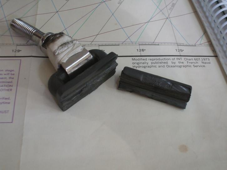 |
| Broken sail slide |
Michelle made banana bread which put a smile on Robin´s face then cooked him a yummy dinner. That helped offset the trying times he´s had lately keeping up with repairs. He´s feeling a little glum.
At 0400 UTC which is ummm I guess somewhere around 11pm, we hit the quarter way mark with just 820nm to go at that point. Yes we are counting.
Sunday April 12, 2009
We stitched the new sail slides back on so the main is finished for now. The evening ham net has proved interesting lately. On the Pacific Seafarer´s net tonight, one of the net controllers hailed from Tassie so we had a good old chat. Last night on the net we were all informed that the volcano on Fernandina Island in the Galapagos had erupted. We missed it by a couple of weeks! It´s nice to touch base with the outside world occasionally.
Another tidbit of information: We have yet to come as far west as San Francisco. That is kinda depressing considering we´ve just done over 3,000 miles, admittedly a lot of southing in that.
No wildlife sightings but then again it hasn´t been enjoyable to sit outside for very long. We definitely notice the cooler climate down here. Time to head back to the equator!
Position 25.36S 116.45W COG 272 degrees true SOG 6.0 Wind S 11 knots Waves down to 2.3 meters at 10 secs Barometer 1019hp Temp 21 degrees last night. Brrrrrr. Whatever will we do when we get home to Tassie?
Monday April 13, 2009
Well let´s see what I can come up with for news today. The wind died last night to about 6 knots and there it has stayed ever since. We have averaged 3.9 knots ever since in sloppy messy seas but it of course could be worse so we are trying to grin and bear it. Not much grinning going on but lots of baring!
Robin saw a piece of rope floating past. He said it was the most exciting thing he´s seen for days. Michelle made bread today, and cooked his nibs some stewed fruit in brandy for supper. Gotta keep him happy somehow!
Ok that´s about it from us. Position 25.44S 119.15W COG 272 degrees True SOG 3.9 DTD 590nm. Somebody turn the fan up one notch please. Just one!
Tuesday April 14, 2009
Wind died absolutely around midnight last night. It was so calm not even the flag was twitching. Robin took down all the sails and we drifted on the current, which thankfully was in the direction we wanted to go, and after he´d set the guard alarm on the radar he went to bed. We actually made about 1nm an hour and saved the sails from a death worse than slatting, the one where Michelle takes a knife to them to shut them up! The worst is when the sail snaps back and shakes the entire rig which in turn vibrates the entire boat. Not good.
Michelle woke up and decided to test a small part of the jib and all seemed to be good. We had about 5 knots of wind which is enough for us to move in. So we decide to put up the main. Ha! That definitely decided matters. The wind immediately died. We ended up being becalmed for a total of 12 hours in the last 24. Definitely not suitable conditions for making a lot of progress but we were actually happy to take a deep breath and relax for a while. We left the sails down until 2:30pm this afternoon when finally a modicum of breeze deigned to appear and we started to move along at 3.5 knots. By 9pm the wind had freshened to 9 knots and we put up the entire main and now we sit at a comfortable 5.5 knots. We are happy.
Position late this afternoon was 25.31S 120.22W. COG 270 degrees True. Speed over ground 4 knots.
Wednesday April 15, 2009
We are actually a wee bit grumpy today. The constant attention to sails means little relaxation time. At 0300UTC last night we had the usual sloppy seas, the usual light air, the usual roll, plodding along and barely making progress but still we were moving forward. By 0600 there was nada wind. Not a breath of air. There is a big High Pressure system right on top of us. By 0830 Robin got up and decided he could keep the boat moving. The wind had swung around to the North so he unfurled the jib and bobbed along at under 4 knots. It only lasted for 2 hours but at least it was something then there was no air until 17:00UTC today. At that point Michelle noticed we were actually bobbing backwards and put a right royal stop to that. She turned on the engine. She figured the batteries needed some extra help to charge up anyway. Position at that point was 25.30S 122.47W. We had made a whopping 17nm in all that time lol. The grand total for yesterday was just 56 miles, an all time low for Warrior. The GPS says we are back to 7 days from destination at this speed! Just as well we put three months supply of food on board. We may yet need it!
We had some rain today off an on with associated squalls which lasted about 15 minutes. At least the salt crystals are disappearing. Other than that, there´s been no wildlife. Not even a flying fish anymore. I guess we will eventually get to where we are going. It seems interminable at the moment. Michelle is very thankful for the two nets of an evening and someone to chat to even if it´s just position reports.
Thursday April 16, 2009
Started with not much going on. Had motored in the morning for a couple of hours for something different to do after flopping all night. A little wind began from the north, just enough to keep moving without too much sail flapping. A rain area appeared ahead and we just sailed straight into it simply because we would have had to use the motor again to do anything else. The rain washed the boat, just, the wind switched around and we ended up on the opposite tack on the opposite side of the modest squall. Nothing predictable but time passed. Late afternoon another rain squall area appeared on Robin´s watch. He just missed it to the south and we were just beginning to feel like we were sailing reasonably when the wind swung almost due west. By this time the waves had dropped so we were able to sail in as little as 2 knots of wind. So off we headed NW making a restful speed of 1-2 knots (only 30 days to Pitcairn at this rate). The breeze was remarkably stable for a change allowing a course of 305 degrees all night with sails all loose to make the most of the lightest of breezes. Sometimes we did 4 knots but not often. This morning it has strengthened to 8 to 10 knots and swung so that our best course is 320 degrees at 5 knots with sails and lines tightened for close haul. Still minimum of wind waves so that´s good. The Grib files say that in 1 to 2 days time the wind will shift from W to NW and strengthen to 15-20 knots. So we are gambling that the Grib files are right and staying on the port tack. When the change comes through we will be well north and will be able to cover a big chunk of remaining distance directly to Pitcairn. Gambling on a weather forecast being correct!? Robin maintains there is a Heisenberg Uncertainty Principle concerning weather: They can´t ever get both the wind speed and direction correct at the same time. We´ll be finding out as this major wind shift is around an existing southern Low - it should be reliable!
We had a wildlife sighting today. We saw a huge pod of whales... well we saw their plume in the distance way yonder but after seeing nothing for days this was quite the excitment! They lazed around for a good 45 minutes on the surface although we just couldn´t get a good enough sighting on them to determine what species of whale they were.
Friday April 17, 2009
We are trying to string this journey out so that we can say we took just as long to get to Pitcairn, a trip of a mere 1000 miles as we did from Galapagos to Easter Island, a trip of over 2,000. Completely absurd how these things work out.
We had a few interesting bits throughout the last 24 hours. A doozy of a squall which we negotiated at 7.5 knots heeled at 30 degrees. It was quite the speed rush after bobbing the last few days. Sadly the joyride only lasted 30 minutes then it was back to the mundane. It´s quite pretty out here today. The sun is shining overhead but all around us on the horizon are towering cumulus, showers of rain and every now and then a gorgeous rainbow. Times like these you take five and remember to enjoy yourself.
 |
 |
| Rain Squall | |
We saw quite a bit of birdlife today, a good mixture of brown boobies and white terns. We missed out on seeing Ducie Island. It was dark when we went past and we decided not to tack too close since it´s surrounded by reefs.
Position 23.55S 125.26W COG trying very hard to head 240 degrees but not succeeding. Tacking back and forth waiting for the north westerly change that is supposed to arrive some time later tonight. SOG sometimes 2 knots, sometimes but not often, 5. Think we will succumb to the iron horses for a few hours and see if we can find some wind.
 |
| Making progress? |
Saturday April 18, 2009
We are sailing, we are sailing. After an extremely dead no wind 12 hour overnight drift, the wind finally got up around 1400UTC this morning and we have had a steady 6 to 8 knots ever since. That means we do a constant 4.5 to 6.5 knots which further means oh my god we may arrive in Pitcairn one day soon!
Last night the sea was pure glass. It was amazing to watch 15 foot waves come gliding towards you with nary a ripple breaking the mirror-image surface. The time interval between waves was 14 seconds which makes for a slow steady rise and fall which you almost drift over. We didn´t lose much ground last night during the 12 hour drift, only about 4.5 miles. However the total miles towards destination yesterday was a mere 35, which I think is our all time record low.
Position at around 1800 UTC today was 24.04S 126.04W and sadly I think most of that distance was covered in the last four hours. COG heading straight to Pitcairn, do not pass go, do not collect $200. SOG currently a steady 6.4 knots. DTD a couple of hundred miles to go. Not much on the scale of things. If this wind holds we should arrive at Pitcairn the day after tomorrow.
Sunday April 19, 2009
Well we are still plugging away at closing the gap towards Pitcairn. At least we do have wind although we can no longer make a direct course and will need to do some more tacking at some point. The sun has been shining, we took our showers on deck again and it was warm enough not to have to even towel down. We are seeing more and more bird life everyday but nothing different, just the brown boobies and the white terns. Not even another ship to be seen the entire time which we are not sorry about.
Nine of Cups is also headed to Pitcairn and we received an email from them which made us laugh. We were commiserating about the lack of wind to them a few days ago and Marcie replies, yes we have the same conditions except when that light breeze arrives at us (they are travelling two days behind us) it has already been used and therefore is even more inefficient. I can just see the add in the next newspaper.. wind for sale, 1.8 knots only slightly used. Ineffectual for moving a 50 foot boat but good for drying your laundry, going very cheap. Felix from the other boat, La Rabasse, that was with us at Easter Island has just been diagnosed with a stomach tumor and they have flown him out to Santiago for immediate therapy. The port authorities have managed to get his small yacht into the tiny culeta of Hanga Piko. We are certainly glad we do not have these worries to contend with. Lack of wind or the wrong direction thereof seems very trivial indeed.
Position at 1800UTC 24.40S 128.05W COG 220 degrees SOG 3.5 knots DTD 111nm. Slowly closing the gap!
Monday April 20, 2009
The wind is only just cooperating, coming from the WNW and making life difficult but we are at least slowly drawing closer to Pitcairn. Out speed is an impressive 2.5 knots and by 0300 UTC this evening we still have 75nm to go. At this speed we may not make it in tomorrow. All we can do is shake our heads and laugh at the absurdity of it all. Our position early this afternoon was 24.51S 128.26W. At 0900 UTC when Michelle had woken up for her shift Robin informed her that we had a 30° windshift in our favor and were now only 10° offcourse. She got all excited but it only lasted two of her three hour watch. Then it swung back to where it had been earlier and we were back to 40° offcourse. The respite was nice while it lasted.
Pitcairn Island
Tuesday April 21, 2009
We were both up on deck at the crack of dawn this morning searching avidly but still no sight of Pitcairn on the horizon. Robin made coffee and we sat out in the cockpit enjoying the early morning when suddenly he jumps up and shouts LAND AHOY! I guess you had to be there to understand the jubilation. For the rest of the day we watched as the island grew in size, battling with the wind which was of course coming from right where we wanted to go. With 36nm to go we caved in and turned on the motor, occasionally pulling out the jib when the wind veered enough off our course and furling it again when it came back around. We finally made landfall right on dusk, circling around in Bounty Bay until we found a patch of sand that was semi clear of rocks and dropped anchor. Brenda, who we would get to know well over the next couple of days, immediately called us on the Radio and welcomed us to Pitcairn and said she would see us in the morning and clear us into the island etc. David, who has been monitoring our progress on the evening Ham Net also called us welcoming us and we chatted for a while. The anchorage is quite the rock and roll experience being an open roadstead but we were sure happy to be here finally. Everyone always mentions Pitcairn in the same breath as the word remote. It´s odd but we felt more remote on Easter Island. Ile Gamber is only 300 miles away but I guess there is no air access on Pitcairn so you are limited to ship travel.
 |
 |
 |
| Yes we´ve made it to Bounty Bay! | ||
Wednesday April 22, 2009
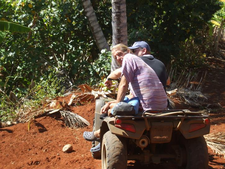
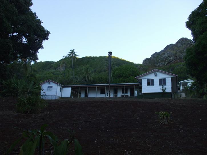
Brenda called us up around 9:30 in the morning and got us moving towards shore. We finally managed to arrive around 10:45am. We were greeted by a number of Pitcairners who had come down to the dock to welcome us and amongst them was David who had kept us company on the Ham Radio over the last 13 days of our journey. It was wonderful to put a face to the voice. After completing all the introductions and filling out the necessary forms for customs we headed by buggy bike back to Brenda and her husband, Mike´s place where she finished stamping our passports. There were a lot of people there, too many to remember and we sat around eating fresh papaya and drinking cups of tea for about an hour, exchanging chit chat. Next up Brenda and Mike decided we needed to see the island, so back on the dune buggy bikes went we and off we headed for a tour of the island.
Pitcairn is so linked to the Mutiny of the Bounty that it´s easy to forget that it was once inhabited by Polynesians somewhere between the 12th and 15th centuries. When the mutineers arrived they found marae platforms and stone images, but being devout christians (one has to wonder about this fact) they tossed them all into the sea. According to our trusty Lonely Planet Guide the original Polynesian settlement died a slow death when Mangareva was devastated by overpopulation. The Pitcairn group of islands provided quarry items for tools, red tropic bird feathers, green turtles and other ´luxury´ goods. Anyway by the time Philip Carteret discovered the island on the HMS Swallow, there was no sign of habitation. Sadly or fortunately whichever way you look at it, he had mischarted the island, an error of 300km which made it extremely difficult to locate. Hence when the mutineers arrived and others came looking for them, they completely missed Pitcairn as it just wasn´t where it was supposed to be. They got as close as Ducie in discovering the brats though.
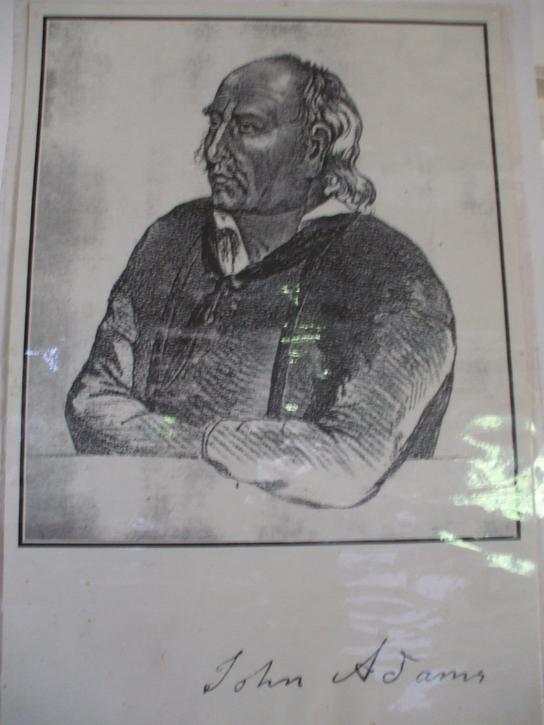
The eight mutineers, led by Fletcher Christian, arrived along with six other Tahitian men and 12 Tahitian women and one child. The idyllic life ended when McCoy finally managed to make some lethal alcoholic concoction from the roots of the Ti plant. Presumably wood ethanol did them in as McCoy threw himself into the sea, Quintal was killed by Adams and Young after he went on a rampage, apparently in self defense. A year later Young died of an asthma attack which left John Adams as the sole survivor of the 15 men who had arrived just a decade previously. The three main family names which have survived down to the present day are Christian, McCoy and Adams and Brenda Christian is decended from all three lines.
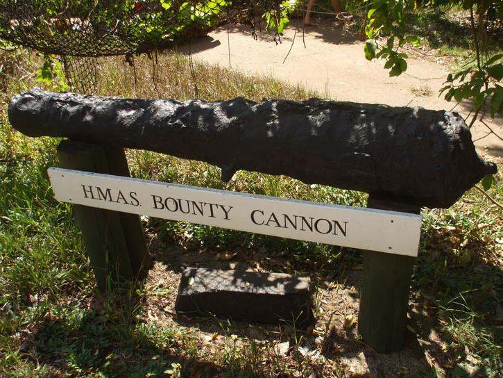
So armed with this info we set off to discover this home of the renegades decendants. All along the way Brenda would stop to drop something off to one of the residents or collect something. First stop was to Mr Brown´s place (not sure of the lineage of the Brown name but he was born on the island) and there outside his front fence was one of the canons of the bounty. There are apparently another one or two currently in Australia being restored.
 |
| Can I touch it? |
Next stop was over to the other side of the island to the anchorage known as Tedside. Here we met Tom, a visitor who had been on the island for a while and was obsessed with catching a travally that had continuously escaped being snared. He was leaving the day after tomorrow on a visiting yacht and was determined to spend the next 24 hours chasing this fish. You can´t help but root for the fish since a really big travally is inedible.
 |
 |
| Tedside | |
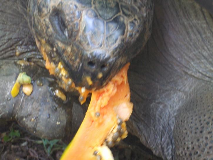
Next we made a pit stop to say G´day to Mrs T, the islands sole remaining Galapagos tortoise. For a long time they thought she was a male and so called her Mr. T. Now she is Mrs T or Misty as it turns out she was really a gal. She´s about 70 years old now. She certainly made a pig of herself chomping into bananas and papaya. She lives on the banana plantation and bananas are a major part of her diet.
 |
 |
| Mrs T. | |
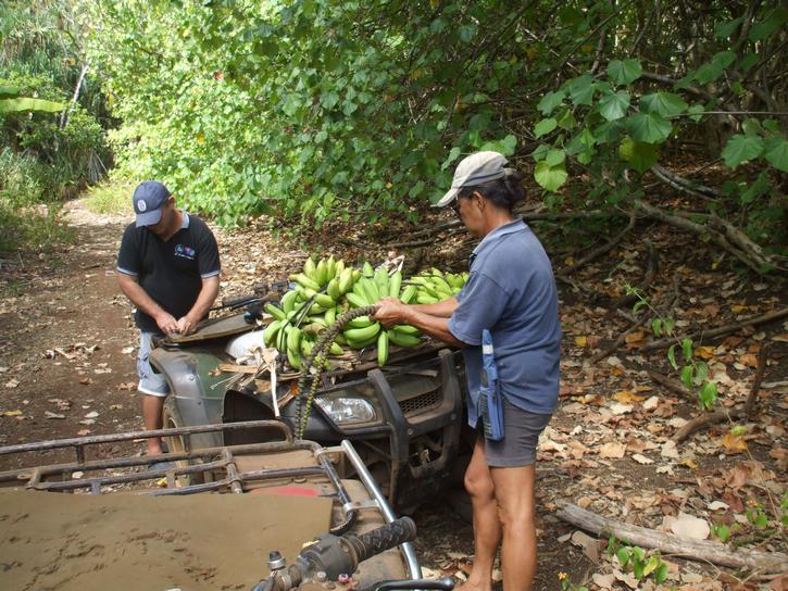
In addition to the stunning views, we were impressed with how many fruit trees they had. The entire island was a fruit orchard with oranges, mandarines, lemons, bananas, guavas, coconuts, passionfruit, breadfruit, watermelon, custard apple and papaya to name just what we saw. As we progressed around the island, Brenda continually stopped to harvest fruit and by the end of the day she had an entire basket filled for us. We can´t remember how many years it´s been since we have eaten fresh passionfruit.
 |
 |
 |
| Bountiful Fruit | ||
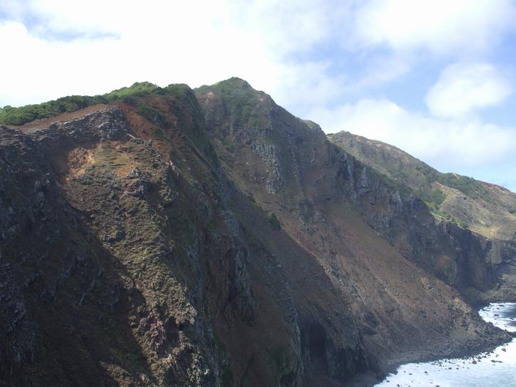
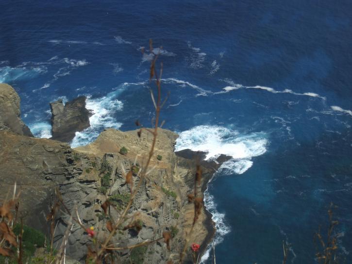
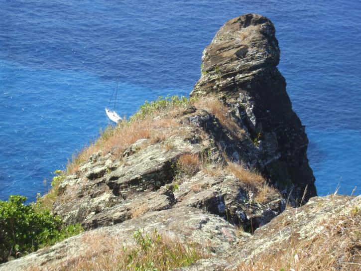
We continued on around the island, stopping at various outlooks to take in the stunning vista of the exceptionally rugged shoreline. There is not a beach anywhere in sight on Pitcairn, testament to the constant pounding it receives from ocean swell. The piece de resistance for us was the natural rock pool just around from St. Paul´s Point. We are so hoping to be able to snorkel down in there if the weather holds. The entire island has the most amazing place names although some have been changed. Down Rope is an anchorage on the southside of the island, the only access being.. a rope. Others spots have names like Where Dan Fall, Johnny Fall, Tom Off, and our all time favorite Oh Dear. Looking at the cliffs it´s easy to see how one could fall. Mostly people fell collecting bird´s eggs, chasing goats or simply fishing. Mmm cliff fishing... ok!
 |
 |
 |
 |
 |
 |
| Rugged shores | ||
At Ship´s Landing, which is not at sea level but on top of a cliff between Bounty Bay and St Paul´s Point, we found a placard in place which indicated the US Army Corp of Engineers had been out to survey the island in 1967. We simply can´t imagine why. Anyone have any ideas?
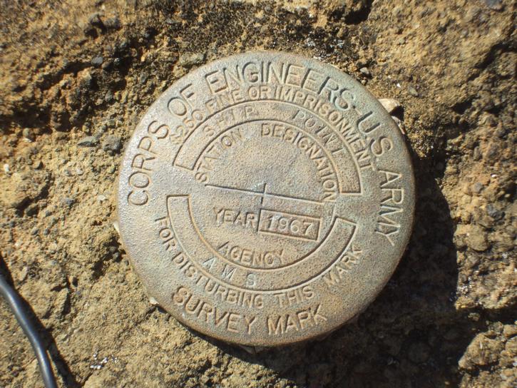 |
| Us Army Corp of Engineers Survey Placard |
We arrived back at Mike and Brenda´s place completely covered in dirt. The only paved road on the entire island is the one coming up from the warf, an amazing incline called the hill of difficulty. Everything else is approaching bulldust. They haven´t seen rain for quite a while apparently but everything still looks lush and green to our eyes.
 |
 |
 |
 |
 |
 |
| Overland trails | ||
We finally managed to say our farewells promising to return tomorrow for a meal, and began walking back down towards the dock. We didn´t manage to walk half a mile before being snagged by the island´s pastor and then David our Ham Radio friend trundled past and we had to hop on his bike and head back to his house. He had baked us fresh bread and raisin scones and gave us a bag full of the most wonderful sausages we´ve tasted since the States. While sitting chatting with him we heard a call on the VHF. There was another yacht passing by, saying hello but too busy to stop for a few hours. It was a massive yacht, over 100 feet and the crew aboard were on a delivery where each hour you arrive in advance means money. We finally made it back down to the dock area at dusk and by now the waves had increased substantially. We had only put our small dinghy engine on as it was relatively calm earlier in the day. Fortunately the Pitcairners are pros at reading the surf and they gave us the signal to head on out, and we made it high and dry for a change. It was rough getting back aboard Warrior but not too rough that we needed to reanchor the boat.. yet! Hopefully the weather would hold and we get another day or two ashore.
Thursday April 23, 2009
It is Michelle´s birthday today and she began the day as spoilt as ever with breakfast in bed! We lazed around reading books until midday as we knew a charter sailboat was arriving around that time to drop off some visitors to the island and they would require the launch. We figured since the swell had worsened a little we would also make use of the launch today to get ashore. Brenda and Mike and Shawn and a few others were on the dock to greet the two visitors, Patrick and Mark, who hailed from Belgium, and had been planning this trip for over 20 years. Last year they attempted to get to Pitcairn and the yacht they chartered had an accident just outside of Tahiti and didn´t make it so they came back for round two this year. Very nice couple of guys.
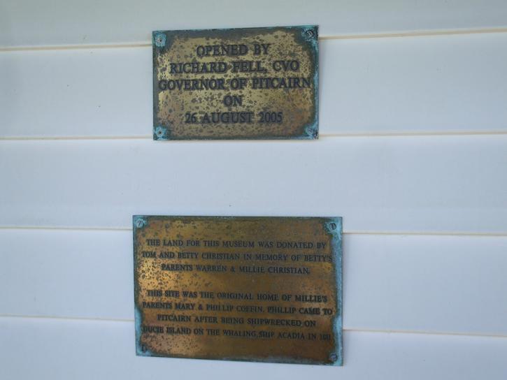
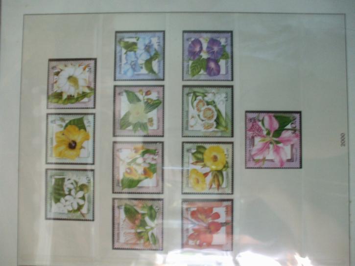
We headed on up to Brenda and Mike´s place again to drop off all the luggage and then they organized for the museum to be opened for the four of us and off we trotted to check out their collection of memorabilia from the HMS Bounty, and their impressive stamp editions.
 |
 |
 |
 |
 |
 |
| It was too dark inside to take many photos | ||
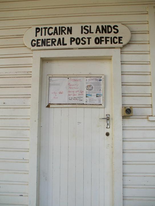
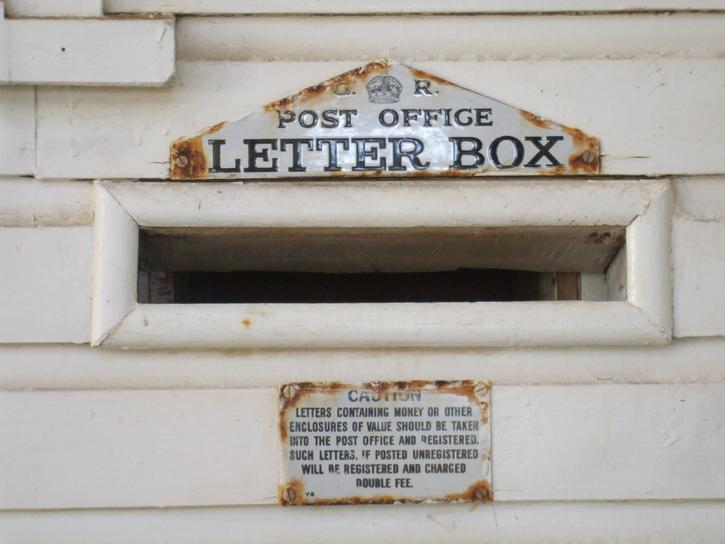
After the museum we wandered down to the Pitcairn post office where we just wanted 10 postcards and a few stamps. The two Belgian guys, however, had been planning this for a very long time and had come prepared. They had over 500 postcards already labeled with addresses. The poor girl behind the counter was so flumoxed she had to call her boss to come open the safe to grab more stamps. It was an impressive ordeal and amazing to see how much preparation had gone into this trip for them.
 |
 |
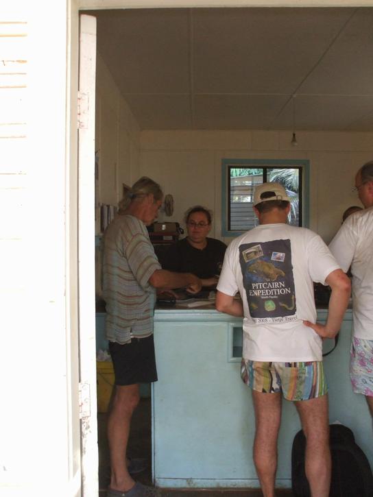 |
| Post office madness | ||
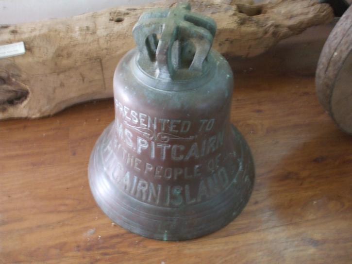
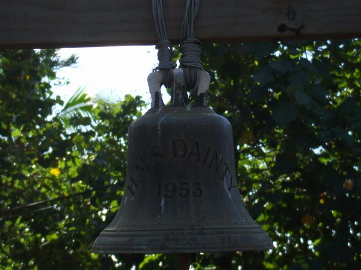
Also located in the village square beside the post office was the Bounty Anchor set before the town hall, and the Seventh Day Adventist Church. This is the only church on the island. There were aslo a couple of ship´s bells which had been donated to the island hanging up here.
 |
 |
 |
| Snapshots around the town square | ||
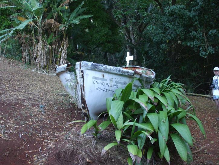
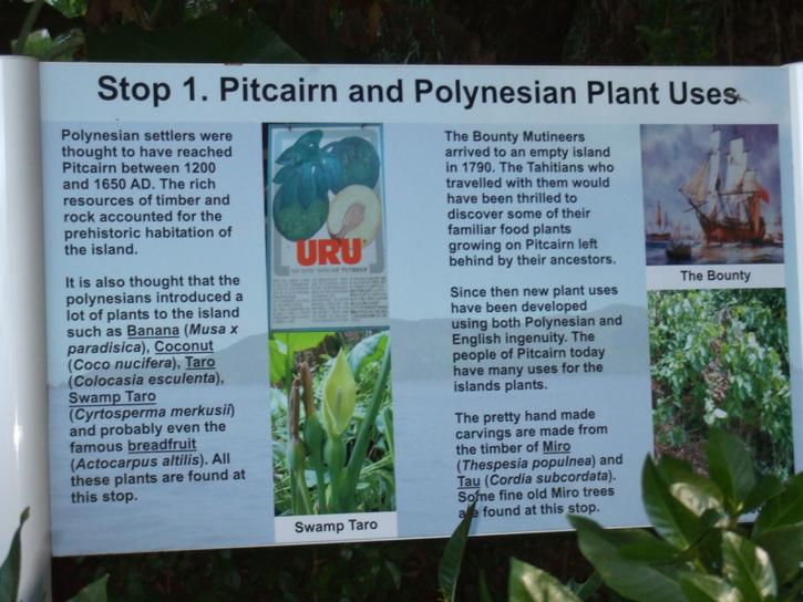
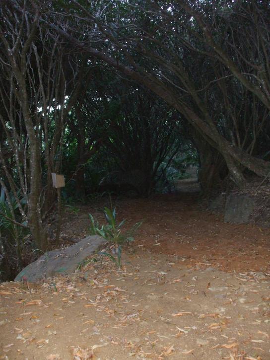
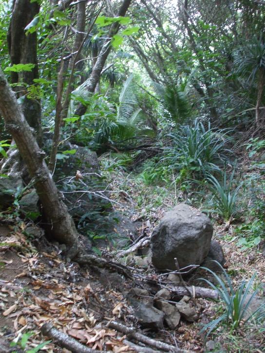
As soon as the two Belgian guys had finished in the post office we hiked over to check out the Adam´s family graves, and then sauntered down passed the local school to the ecotrail and then on up to Christian´s cave, a very easy 30 minute saunter. There were placards the entire way describing various indiginous plants and other tidbits of information.
 |
 |
 |
The wildlife on Pitcairn is unusual. Because of its isolation, no mammals apart from rats and goats which were brought by people made it here. There are however an endemic bird, plants, lizards, snails and crabs. The Pitcairn Warbler is their very own species of sparrow. There are 11 species of plant endemic to Pitcairn although most endemics are under serious threat nowadays. Thatch, Rata and Mahame are found only in a few spots throughout the island. The yellow Fatu which was presumed extinct was found near Tedside in 2003. This newly discovered plant was subsequently destroyed by a landslide caused by goats in 2004 however cuttings had been taken and those cuttings are surviving nicely under much care. Only 11 Red Berry plants survive on Pitcairn and it´s a wonder there is that many when goats tend to destroy most plantlife. Arlihau a pretty shrub with a daisy type yellow flower is also struggling to remain on planet earth. All these plants are only found on Pitcairn and nowadays the locals are aware of the importance of sustaining these precious species. Lantana, Lillies and the common bindy are also serious threats to these native plants.
 |
 |
 |
 |
| Snapshots along the Eco Trail and Christian´s Cave | |||
And then it was time to head back to Brenda and Mike´s place. They had invited us all for dinner. We arrived to find they had even organized a present for Michelle and the dinner consisted of fresh red snapper, smoked fish, breadfruit cooked two different ways as Michelle had mentioned earlier in the day that we had never tasted it, and banana split and chocolate icecream afterwards. What a treat for the birthday girl and for all of us! We had to call it quits around 9pm as the weather really was starting to get rough and we needed to get back on the boat. That was an ordeal in itself and we watched, amazed as Brenda, this little bundle of 57 year old indefatiguable energy, manoeuvered her launch out in the waves and dropped us off on a bucking Warrior. She will ever be an inspiration to us.
Friday April 24, 2009
We had a fairly restless night last night keeping tabs on the weather and alert for any sign that the change was on its way. We didn´t want to move the boat in the dark but we may as well have since worrying about it gnawed away at our sleep time anyway. At the crack of dawn the squally weather looked about to break so we quickly upanchored and motored around the island to the southern point off Point Christian where we found some rock strewn sand patches in 70 feet of water and threw down the hook. Michelle immediately went to sleep since she had spent most of the night awake. Robin worried at weather files and declared when Michelle awoke a few hours later, that we were safe enough here for another night. We won´t make it ashore again so we sat all afternoon writing out postcards which the launch came and collected off us. We said our farewells to Brenda. We are sorry to leave here. It would have been perfect to be able to spend an entire week relaxing. The hospitality of this island has been overwhelming and we have been truly spoilt. They will certainly remain in our hearts for a long time to come.
 |
 |
 |
 |
 |
 |
| A few more shots from Pitcairn | ||
Passage to Ile Gambier
Saturday April 25, 2009
We finally got underway about two hours after sunrise this morning. It will be a rough passage to Gambier with probably lots of rain. We are heading as far north as we can to get out of the main brunt of the weather system, allowing it to pass by the Gambier before approaching it. It is only 277nm but by tomorrow the wind will be coming directly from there making life difficult. At least we are sailing and all is well. We are putzing along under staysail and double reefed main at 4.5 knots directly into the wind. Will probably take us three days to get there.
Position 24.34S 130.41W COG 292° True SOG 4.5 knots Wind NNW 18 Waves NNW 2.0 mtrs DTD 241nm.
We are truly looking forward to a calm anchorage. It seems like months. Wait it has been months!
Sunday April 26, 2009
Heavy rain squalls overnight. At least the boat got a good fresh water rinse. Sadly Michelle decided it was just a tad too cold to hop out there and wash her hair in the midnight shower! Today we have had more of the same although this morning we had a lovely three hour reprieve where the waves died right down, the wind remained constant and we were able to relax for a bit. This afternoon the rain squalls have begun again which keeps you on your toes. Otherwise nothing much to report. Robin is cooking dinner tonight - Bonus. We haven´t caught a fish in days so he is using the last of our fresh meat. After that Michelle has to become inventive. We heard the other day on Pitcairn that the Gambier has no fresh eggs at the moment. That is going to hurt!
Position 25°15S 132°08W Course 297° True SOG 3.5 Wind SW 10 knots DTD 158nm. Bring on the Gambier!
Monday April 27, 2009
We have had a pretty rough 24 hours with lots of heavy rain, lots of squalls, 20 to 25 knots of wind and we´ve spent the last 12 hours trying to slow Warrior down as we knew we wouldn´t make it in before dark to negotiate the coral reef. Ever tried to slow down a racehorse? We are moving along under just a tripled reefed mainsail which is a very small scrap of cloth on Warrior´s rigging and she´s still doing 5.0 knots. Where was this wind when we were headed to Pitcairn lol. It´s either a feast or a famine.
Just 77nm to go but we want to time entry into the lagoon for when the sun is 20° above the horizon off our bow, to better see coral heads with. Last thing we need in 25 knots of wind is to go plowing into a small reef. We also need to miss a reef to the east of the Gambier, Portland Reef. We wouldn´t necessarily hit it as it has a minimum depth of 9 meters but it would be hallaciously rough in this swell. Otherwise we are well, Robin´s huge pot of left over stew is for dinner so Michelle gets two nights off from cooking in a row. Now that´s a holiday!
Rocking right along at Position 24°02S 134°10W COG 269° SOG 5.0 knots Winds S 20 to 25 Swell S 3.0 mtrs DTD 77nm.
We had a beautiful white phased brown booby come say hi earlier today. They really are a pretty bird with their brown markings.
Mangareva, Ile Gambier
Tuesday April 28, 2009
We arrived safe and sound after a long night of poring over the charts trying to establish whether or not to enter this lagoon in 20 knots of wind and 3.0 metre seas. We finally figured we could do it and by dawn we could see the lumps of land poking up occasionally over the peaks of the waves. We did have a backup plan - if we saw breaking waves we would probably abort. Although we´d gone surfing in Warrior before in El Salvador, surfing over coral bars just didn´t really appeal to us.
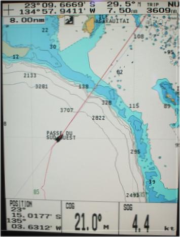 |
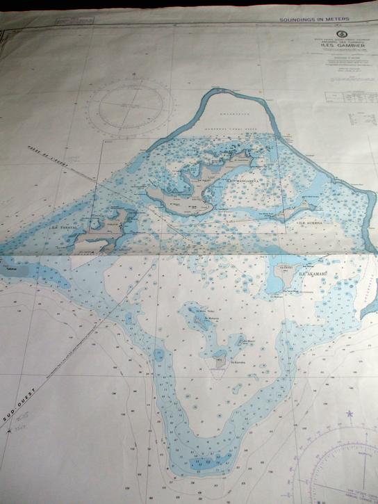 |
 |
| What the Chart Plotter and paper chart were telling us and what our eyes were telling us. Gulp! Yes we can miss all those obstacles! |
||
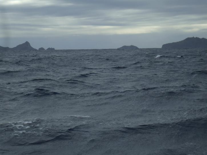
We inched our way forward towards the coral bar into the lagoon and well... there wasn´t a breaking wave to be found. The swell followed us in but other than that it was very uneventful. It was quite disconcerting to look out over what looked like an innocent body of water knowing that the charts told a completely different story. We had to carefully negotiate the next 8 miles avoiding coral heads and reefs none of which could be glimpsed in the heavy overcast matte grey water. Nothing to it!
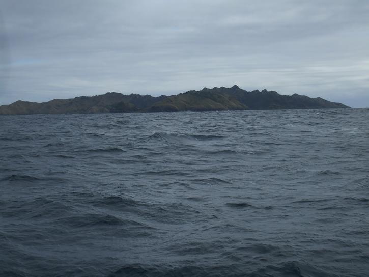 |
 |
 |
| First glimpses of the Gambiers | ||
After 4,300nm and 8 weeks via the Galapagos, Easter Island and Pitcairn we have finally found a calm anchorage. Hopefully we can find internet access now to get all the backlog of webpages uploaded. We went ashore late this afternoon, checked in with the Gendarmes, did a wee bit of shopping and tried to not have cardiac arrest at the prices. We knew French Polynesia was going to be expensive but $1.00 per egg and $10.00 /kg for tomatoes. How loud can you say ouch! Heading to bed for a good night´s sleep.
Thursday April 30, 2009
We are finally safely tucked up in a fairly comfortable anchorage although it continues to blow 20 to 30 knots and will do so for the next three days by the look of the weather charts. We are not sure what happened to that image in our minds of sunny beaches, swaying coconut palms, cocktails on decks, bathing in crystal clear water.... Well I guess it will happen eventually. We are planning on being here for 2 weeks although I wouldn´t mind being here a month. It seems all I´ve done lately is look at the big blue wobbly thing wobbling wildly.
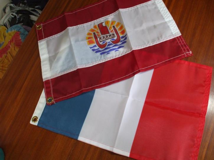 |
| New flags to fly |